Primarily for general aviation discussion, but other aviation topics are also welcome.
By PaulB
#1617891
Apparently there's a 30 day trial of ForeFlight (Europe) (iOS only I believe).

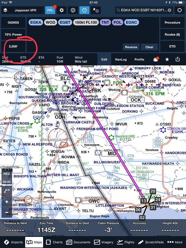
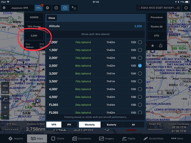
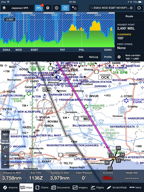
There are some on the Book of Faces saying that it "blows SkyDemon & runway HD out of the water" being "a 100 times better". I've had a play, admittedly for only about 10 mins and it seems to be aimed at the IFR market rather than the VFR market that SD & RwyHD are aimed at.


I have played with it for about 10 mins and can't see what the hype is about (as a VFR person). Has anyone else looked at it?
User avatar
By Peter Mundy
#1617892
Yes - as a VFR flyer totally underwhelmed - I think it verges on being useless - €179 down the drain as far as I am concerned.
By PaulB
#1617893
Perhaps it's user error, but I can't snap a route to anywhere without choosing "nearby" and can't snap to a VRP at all.
By Stu B
#1617992
What's it like for covering unlicensed airfields/private strips? Non-US-type "airspace" types (ATZs, airsport areas, LARS boundaries, listening squawk areas? Many othe US products are deeply flawed by "assuming" the rest of the world operates as if it were just one more US state.
By PaulB
#1618009
i've no idea.... I haven't got that far with it... I can't remove airways, see "taxi diagrams" for the likes of Gloucester or Coventry or see NOTAMs on the chart!

This could all be down to user error!

(I think for IFR it may well be very good)
By PaulB
#1618037
G-BLEW wrote:
see NOTAMs on the chart!


Foreflight does not display NOTAM graphically as far as I am aware.


ahhhh, that would explain that, then. TBH I thought that would be a given, given the way some are raving about FF on Facebook.

I'm wondering if comparing it to SD is like comparing apples and oranges?
By chipmeisterc
#1618231
I had a play with the web version a couple of months back and it wasn't possible to specify route altitude or vary it per leg - A fairly large and somewhat fundamental shortcoming in uk airspace. Has this now been added?
User avatar
By Dave Phillips
#1618292
Route Altitude - bottom left of FPL box.

Image

Image

Go to profile and you then get their equivalent of SD's Virtual Radar.

Image

No, it doesn't display variable leg altitudes (I guess they will get round to that) but it does calculate them if you change level/speed as part of the FPL (ie inserting something like WOD/N0130F080).
By PaulB
#1619041
I thought that SD Initially said that they weren’t going to develop an iOS version and put their effort into WinCE & Windows Mobile.